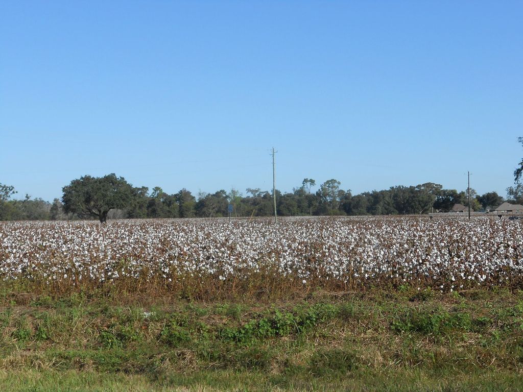
The Black Belt: chalk soil, prairie and history
The name began with the soil and came to mean the people too. To understand Sumter County, start with the dark ground over the chalk and the history it shaped.
- From LivingstonAll around the county
- Eramany eras
- Getting thereAny county road out of Livingston
- BringA field guide, water, good shoes
Look for
- Dark clay soil in plowed fields
- Pale chalk showing on roadside banks
- Tall native grasses on thin ground
- Historical markers by the roadside
- Old schoolhouses and churches
Prairie remnants are usually on private land or roadside banks. Look from the road, never pick or dig plants, and stay clear of fields and fences.
Two meanings of one name
The Black Belt is a crescent of country that curves across central Alabama and into northeast Mississippi, and Sumter County lies near its western end. The name first described the soil: a dark, heavy, fertile clay that formed over a band of soft chalk. Farmers in the 1800s prized it above almost any other land in the South.
Over time the name came to mean something else as well. The rich soil drew cotton planters, the planters brought enslaved people to work the land, and long after slavery ended their descendants remained the majority across much of the region. Today many people use the term for both the land and its people, and both meanings are part of the place.
Chalk under the fields
The chalk beneath the Black Belt formed on the floor of a shallow sea that covered this region in the age of the dinosaurs. Countless tiny shells settled and hardened into soft, pale rock. Where the chalk lies near the surface, it shows as white or gray patches in plowed fields, on road cuts and along the river bluffs. Fossil oysters and other shells turn up in it, and the university in Livingston has studied the region's fossils for many years.
The soil that formed on the chalk is the heavy dark clay that gives the region its name. It swells when wet and cracks when dry, and after rain it turns into a thick, sticky mud that anyone who has driven a dirt road here will remember.
Where the soil was thin over the chalk, the land grew prairie: open grassland with little bluestem, Indian grass, coneflowers and other plants more often found on the Great Plains. Most of the Black Belt prairie was plowed long ago, but small remnants survive on thin ridges, old pastures and roadside banks. Late spring and early autumn, when the grasses and flowers are at their height, are the best times to look for them.
Choctaw homeland
Before it was Sumter County, this was part of the homeland of the Choctaw Nation, who farmed, hunted and traded across the region for centuries. The French, British and Spanish all built forts on the Tombigbee to trade with them, but the land remained Choctaw.
That changed in 1830. Under heavy pressure from the United States, Choctaw leaders signed the Treaty of Dancing Rabbit Creek, which gave up the nation's remaining lands east of the Mississippi in exchange for land in what is now Oklahoma. Most Choctaw people were forced to move west in the early 1830s, a journey on which many died. Some stayed behind, and their descendants still live in Mississippi. Sumter County was created on the ceded land soon after.
Elsewhere in the county: Epes and the Tombigbee bluffs
The story of the forts and the Choctaw on the river is told on the page about Epes and the chalk bluffs of the Tombigbee.
Cotton and slavery
Once the Choctaw were gone, settlers poured into the Black Belt to grow cotton. The dark soil was ideal for it, and the Tombigbee carried the crop to Mobile. Within a generation the region was among the richest cotton country in the world, and that wealth rested on slavery. By 1860 enslaved people made up a large majority of the population of Sumter County.
The houses, churches and courthouses of the period were built with the profits of that system, and in many cases by the hands of enslaved workers. Looking at them honestly means remembering the people who did the work and received nothing for it.
Freedom and what followed
Freedom came in 1865 with the end of the Civil War. During Reconstruction, Black men in Alabama voted and held office for the first time, and freed people built churches and schools of their own. Those gains were rolled back by violence and by laws that stripped most Black citizens of the vote by the early 1900s. Segregation ruled every part of public life for generations.
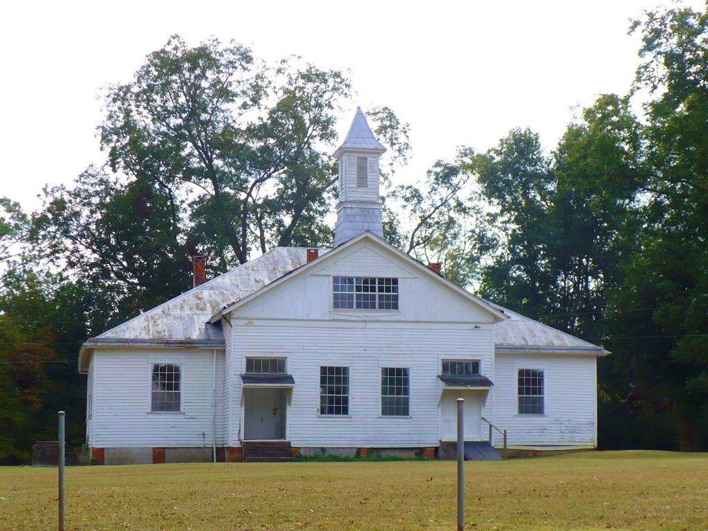
Across the Black Belt, communities and churches kept schools going for Black children with very little public money. The old schoolhouse pictured here stands in Wilcox County, farther east in the Black Belt, and is typical of the frame school buildings once found across the region. Many families left for northern cities in the twentieth century, looking for work and safety.
The civil rights years
The Black Belt was at the heart of the civil rights movement in Alabama. In Sumter County, as across the region, Black residents organized, marched and registered to vote in the 1960s, often at great personal risk. After the Voting Rights Act of 1965, the county's Black majority gradually gained a voice in local government, a change that took years and further struggle to bring about.
That history is still close. Many people in the county lived through it, and its effects can be seen in schools, churches and town politics today.
Seeing it for yourself
There is no single place to see the Black Belt; it is all around you once you leave town. Drive the county roads in late spring or early autumn, watch for pale chalk on road banks and dark soil in the fields, and stop at the historical markers you pass. The small museum at the university in Livingston covers the region's natural and human history; hours vary. Start in Livingston, the county seat, and from there any road will take you into the prairie and its history.