Cuba, Geiger and the county's crossroads
Between the larger towns, Sumter County is a scatter of small crossroads on the old roads and rails. They ask for a slow drive and a light touch.
- From Livingston15 to 25 miles out
- Eramany eras
- Getting thereHighway 116 west, or Highway 11 southwest
- BringA paper map, water, a full tank
Look for
- Country churches with graveyards beside them
- Old water towers above the fields
- Hay bales and grazing cattle
- Pine plantations in straight rows
- Small post offices that serve the farms
Dirt roads in the Black Belt turn slick after rain, and log trucks use the narrow paved ones. Pull fully off before stopping, and never block a church or farm drive.
Places on the old roads
Sumter County has only a handful of towns of any size. Between them lie small communities that grew up where a road met a railroad, where a church and a store stood at a fork, or where a post office served the farms around it. Some have a few dozen houses; some are now little more than a name on a sign and a church in the trees.
This page covers two of them at opposite ends of the county. Geiger lies in the north, west of Gainesville toward the Mississippi line. Cuba lies in the far southwest, on Highway 11 just short of the state line. Neither is a destination in the usual sense. Both are good reasons for a slow drive through the farm country between them.
Geiger and the north end
The north end of the county is open and lightly settled. From Gainesville, Highway 116 heads west toward Geiger through a landscape of pasture, hay fields and woods, with the occasional farmhouse set far back from the road. Geiger itself is a small town with a few streets, churches and houses grouped near the old railroad line.
Like many places in the region, Geiger was larger in the days when the railroad brought freight and passengers and farm families came in to trade. Today it is quiet. Drive through slowly, look at the churches and the older buildings, and remember that the people on the porches live there.
The roads beyond Geiger lead to other small communities and eventually into Mississippi. A paper map helps here, since phone signal can be weak and some country roads are not well marked.
Cuba, near the state line
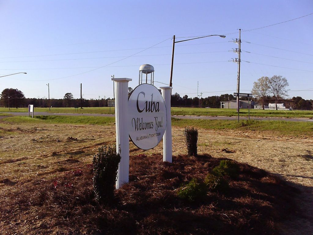
Cuba sits on Highway 11 in the southwest corner of the county, close enough to Mississippi that the welcome sign calls it the front door of Alabama. The interstate passes nearby, so for many travelers coming from the west it is the first Alabama town they meet.
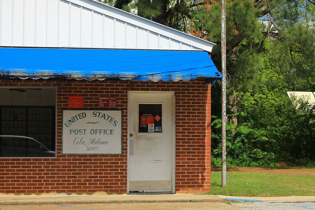
The town is small and spread out, with a water tower, a post office, churches and homes along the highway and the streets off it. The post office is the kind of building that holds a small place together: a brick front, a painted sign and boxes for families from miles around. From Cuba, Highway 11 runs northeast a few miles to York, the old railroad junction, and the two make an easy pairing.
Elsewhere in the county: York, the railroad crossroads
Country churches and cemeteries
The most lasting buildings at many crossroads are the churches. Some are plain white frame buildings with a small steeple; others are brick. Many have a cemetery beside them or behind them, with family names repeated across generations. Black and white congregations in the county have long worshipped separately, and both kinds of church are part of the landscape.
These are working churches and family burial grounds, not historic sites set up for visitors. If you stop, park off the road and away from the drive. Stay on paths in the cemetery, step around graves rather than over them and never move or rub a stone. If a gate is closed or a sign asks you to keep out, respect it. On Sunday mornings and during funerals, drive on.
Some of the oldest graves in the county lie in small family plots on private land, often hidden in a clump of cedars in the middle of a field. Admire them from the road unless you have the owner's permission.
What the farms grow now
Cotton once covered much of this land. Today the farm country around the crossroads is more mixed. You will see cattle on pasture, round hay bales lined up at field edges, and fields of soybeans or corn, with cotton still grown in places. Much former cropland has gone to pine, planted in straight rows and cut on a long cycle; log trucks on the narrow roads are part of that business. Here and there in the Black Belt you may pass a pond used for raising catfish.
The soil explains much of this. The heavy, dark clay over the chalk holds water and turns sticky after rain, and the thin soils on the chalk ridges suit grass better than row crops. The page on the Black Belt and its chalk prairie has more on why the land looks the way it does.
Driving the back roads
The roads between the crossroads are narrow and often have no shoulder. Drive at a pace that lets you stop for a tractor, a log truck, a dog or a deer, and pull completely off the pavement before you stop to look at anything. Dirt roads that look firm in dry weather can become slick and deep after rain, so turn back if one looks doubtful.
Fill your tank before you leave a larger town such as Livingston or York, and carry water. Services at the crossroads are few and change over time. Fields, woods and drives are private property; a pretty view from the road is not an invitation to walk in.
Putting a drive together
A good loop runs north from Livingston to Gainesville, west on Highway 116 to Geiger, then back south through the farm country toward the interstate. A second loop runs southwest on Highway 11 through York to Cuba. Either fills a morning or an afternoon at an unhurried pace, with time to stop at a church or two. Start and end in Livingston, the county seat, where you can walk the square once the driving is done.