Epes and the Tombigbee bluffs
Near Epes, the Tombigbee cuts into white chalk and leaves pale bluffs above the water. On one of them, Europe's empires took turns holding a small fort in Choctaw country.
- From LivingstonAbout 10 miles northeast
- Erabefore 1830
- Getting thereHighway 11 northeast from Livingston
- BringBinoculars, water, shoes that can get muddy
Look for
- Pale chalk exposed along the riverbank
- The railroad bridge across the river
- Barges moving on the waterway
- Fossil shells in loose chalk
- Herons and egrets along the banks
The fort site is on university land and is not a staffed park.
The white bluffs
Most of the Tombigbee's course through west Alabama runs between low, wooded banks. Near Epes it meets the chalk that underlies the Black Belt, and the river has cut into it to leave pale bluffs standing above the water. The chalk formed from the shells of tiny sea creatures when this whole region lay under a shallow sea, long before there were people to see it.
From the water or the far bank, the bluffs look almost white against the green of the trees. Up close the chalk is soft, gray-white and crumbly, and fossil shells are common in it. It erodes easily, which is why the bluffs keep their steep faces, and also why the edge is no place to stand.
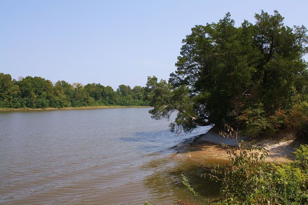
The river photograph at the top of this page was taken downriver at Demopolis in Marengo County, where the Tombigbee runs past similar pale banks. It shows the same river in the same chalk country, a short drive south of Epes.
A French fort in Choctaw country
In 1736 the French built a fort on one of these bluffs, which they called Fort Tombecbe after the river. France then held Mobile and claimed the lands along the Gulf, and the fort gave it a post far up the Tombigbee in the country of the Choctaw, who were its allies and trading partners. It was also a base for a French war against the Chickasaw to the north, a campaign that went badly for France the same year.
The fort was small: a wooden stockade with a few buildings, a garrison of soldiers and traders, and the river below for supplies. Its real importance lay in trade and diplomacy. Choctaw people came to it to trade deerskins for cloth, guns and metal goods, and French officers used it to keep the Choctaw alliance in good order against British traders working in from the east.
It is worth remembering whose land this was. The fort stood in Choctaw country throughout its life, and the Choctaw Nation remained the main power along this part of the river until the treaty of 1830 forced its people to give up their homeland here.
British and Spanish years
At the end of the French and Indian War in 1763, France gave up its lands east of the Mississippi, and the fort passed to Britain. The British renamed it Fort York and garrisoned it for only a few years before abandoning it in the late 1760s; it was too remote and too costly to keep.
Elsewhere in the county: The Black Belt: chalk soil, prairie and history
In the 1790s Spain, which then held Mobile and the Gulf coast, built a new post on the same bluff, called Fort Confederation, to strengthen its own ties with the Choctaw. That too was short-lived. Spain gave up its claims to this region later in the decade, and the young United States took over. Within a few decades the treaty that removed the Choctaw opened the land to settlers, cotton and slavery, a story told on the page about the Black Belt and its history.
Visiting the site
The fort site is owned by the university in Livingston, which has carried out archaeological digs there over the years. It is not a park with set hours, and there is little above ground to see: the wooden walls are long gone, and the story is mostly in the ground and in the view from the bluff. Visits may be possible at some times, often in connection with public events or digs.
If you do visit, stay on the path, keep well back from the edge of the bluff and take nothing away. Artifacts in the ground are the only record of the people who lived and worked here, and moving them destroys that record.
The crossing at Epes
Epes is a small town on the river where the railroad crosses the Tombigbee on a long bridge, and the river has been a crossing point here for a long time. Highway 11 and the interstate both cross nearby. The town is quiet, with a few streets and churches, and its main attraction is the river itself.
The Tombigbee here is part of the Tennessee-Tombigbee Waterway, so you may see a towboat pushing barges, moving slowly and steadily. Herons and egrets work the banks, and in the cooler months the woods along the river are full of birds.
The same river elsewhere
The waterway that passes Epes was built in the late twentieth century to link the Tennessee River with the Tombigbee and the Gulf. Upstream, in Pickens County, the Tom Bevill lock and dam is one of the structures that hold the river at a steady depth for barges.
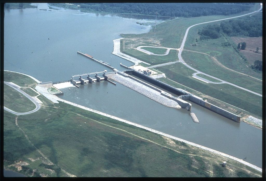
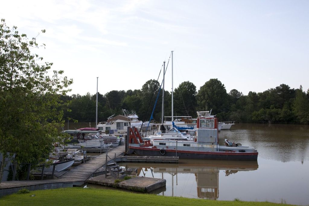
These two photographs show that lock and dam, upstream of Epes, and the boats moored nearby. They give a sense of how the old river has been reshaped, while the chalk bluffs at Epes remain much as the French found them.
Before you go
Autumn and early spring are the best seasons, when the leaves are thin enough to see the bluffs and the heat has eased. Bring binoculars, water and shoes that can take mud, since riverbanks here are slick after rain. Combine the trip with the old river town of Gainesville, upstream on the Tombigbee, or with a walk around the courthouse square in Livingston.