Gainesville: an old Tombigbee river town
Before the railroads, cotton from the prairie went down the Tombigbee from landings like this one. The steamboats are long gone, but the old streets still follow the river.
- From LivingstonRoughly 20 miles north
- Era1830s-1860s
- Getting thereHighway 39 north from Livingston
- BringWater, a full tank, patience on narrow streets
Look for
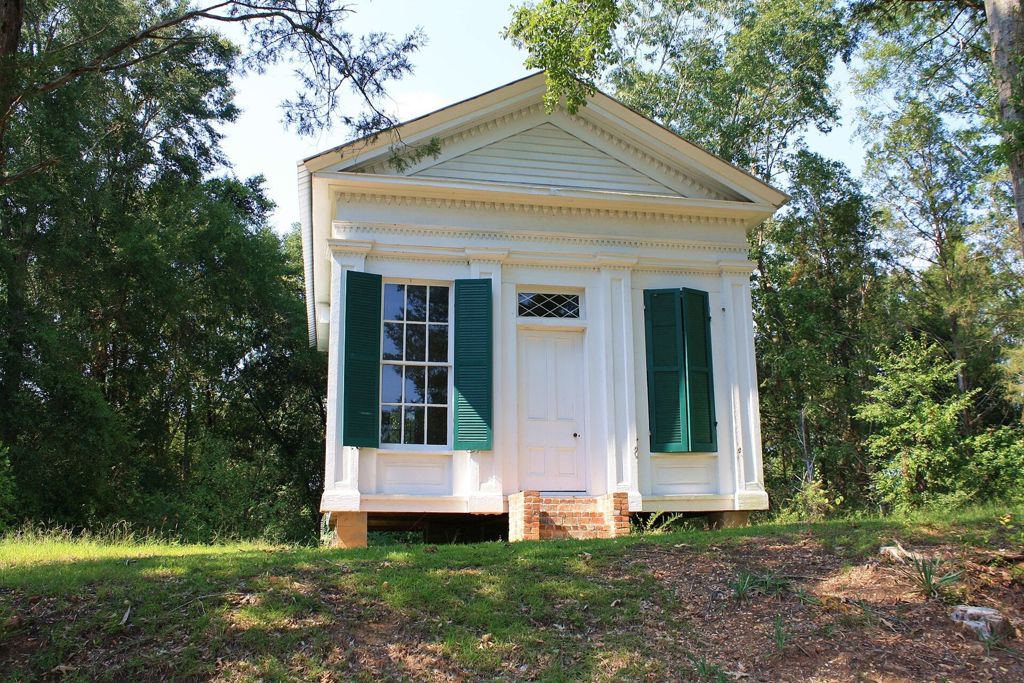
- A small temple-fronted building from the bank era
- Old houses behind picket fences
- The Episcopal church among the trees
- Old graves in the town cemetery
- The river beyond the edge of town
Gainesville has no fuel to rely on and few services, so fill up in Livingston first. Drive the grid slowly; the streets are narrow and people walk in them.
A landing on the Tombigbee
Gainesville grew up in the 1830s on a bluff above the Tombigbee River, on land the Choctaw had been forced to give up only a few years before. Its reason for being was the river. Cotton grown on the farms and plantations of the prairie was hauled by wagon to the landing here and loaded onto steamboats bound for Mobile, and goods for the whole region came back up the same way.
For a few decades before the Civil War that trade made Gainesville one of the busier towns in western Alabama. Merchants, lawyers and planters built houses on the streets above the river, congregations put up churches, and the town had schools and newspapers of its own. Much of the work that kept the landing running, from the fields to the wharf, was done by enslaved people.
The town's decline came quietly. Railroads, not rivers, decided which towns grew after the war, and the main lines passed elsewhere in the county. Gainesville kept its street grid and many of its old buildings, and lost most of its trade.
Walking the old streets
The best way to see Gainesville is to leave the car near the center and walk the grid. The streets are short, many are lined with old trees, and the houses sit well back on deep lots. A good number of them date from the river years; others are later. Almost all are private homes, so the view is from the street.
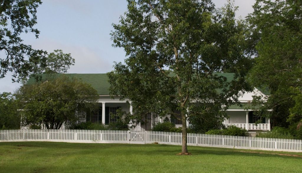
Look for the details that mark the town's age: wide porches carried on square or round columns, tall windows with shutters, chimneys at the ends of the house, and outbuildings at the back of the lot. Some houses have been kept up carefully for generations. Others stand empty and are slowly giving way to vines. Both are part of the town as it is now.
The small white building with a pediment and green shutters, at the top of this page, once housed a bank. Its front is dressed like a little Greek temple, a style that was popular for banks and offices across the South before the war because it suggested solid, permanent money. It is one of the easier buildings in town to recognize, and one of the smallest.
Churches and the cemetery
Gainesville's churches are among its oldest buildings. St. Alban's Episcopal Church is a small frame church in the Gothic style, with steep roof lines and pointed windows, set among trees on a quiet street. There are older Presbyterian and Methodist congregations in town as well, and each building tells you something about the people who paid for it and the years they had money to spend.
The town cemetery holds graves from the river years onward, with iron fences around family plots and stones worn soft by time. Walk on the paths, do not lean on old stones and leave everything as you found it. Remember too that the enslaved people of the town were often buried apart, in graves that were marked with wood or not at all, and many of those burial places are now hard to find.
Elsewhere in the county: Cuba, Geiger and the county's crossroads
If you like small places, the roads north and west of town lead to the scattered crossroads described on the page about Geiger, Cuba and the county's small crossroads.
May 1865
The Civil War ended in Alabama in the spring of 1865, and one of its last acts happened here. In May 1865, after the surrender of the Confederate forces in the region, the cavalry under Nathan Bedford Forrest gave up their arms at Gainesville and the men were paroled and sent home. Forrest issued a farewell address to his troops in the town.
It is worth being plain about who Forrest was. Before the war he made a fortune as a slave trader. In 1864 troops under his command killed Black Union soldiers who were trying to surrender at Fort Pillow in Tennessee. After the war he was an early leader of the Ku Klux Klan. The surrender at Gainesville ended his army; it did not end the fight over what freedom would mean.
For the enslaved people of Gainesville and the surrounding farms, the spring of 1865 meant freedom. The years that followed brought Reconstruction, when Black men in Alabama voted and held office for the first time, and then the violence and laws that took those gains away and built segregation in their place. That history belongs to this town as much as the steamboats do.
The surrender at Gainesville ended his army; it did not end the fight over what freedom would mean.
The river and the roads
The Tombigbee still runs past the edge of town, now part of the Tennessee-Tombigbee Waterway, which was built in the late twentieth century to carry barges between the Tennessee River and the Gulf. A lock and dam on the waterway sits near Gainesville, and the river is wide and slow here. Fishing and bird-watching are the usual reasons people go down to the water.
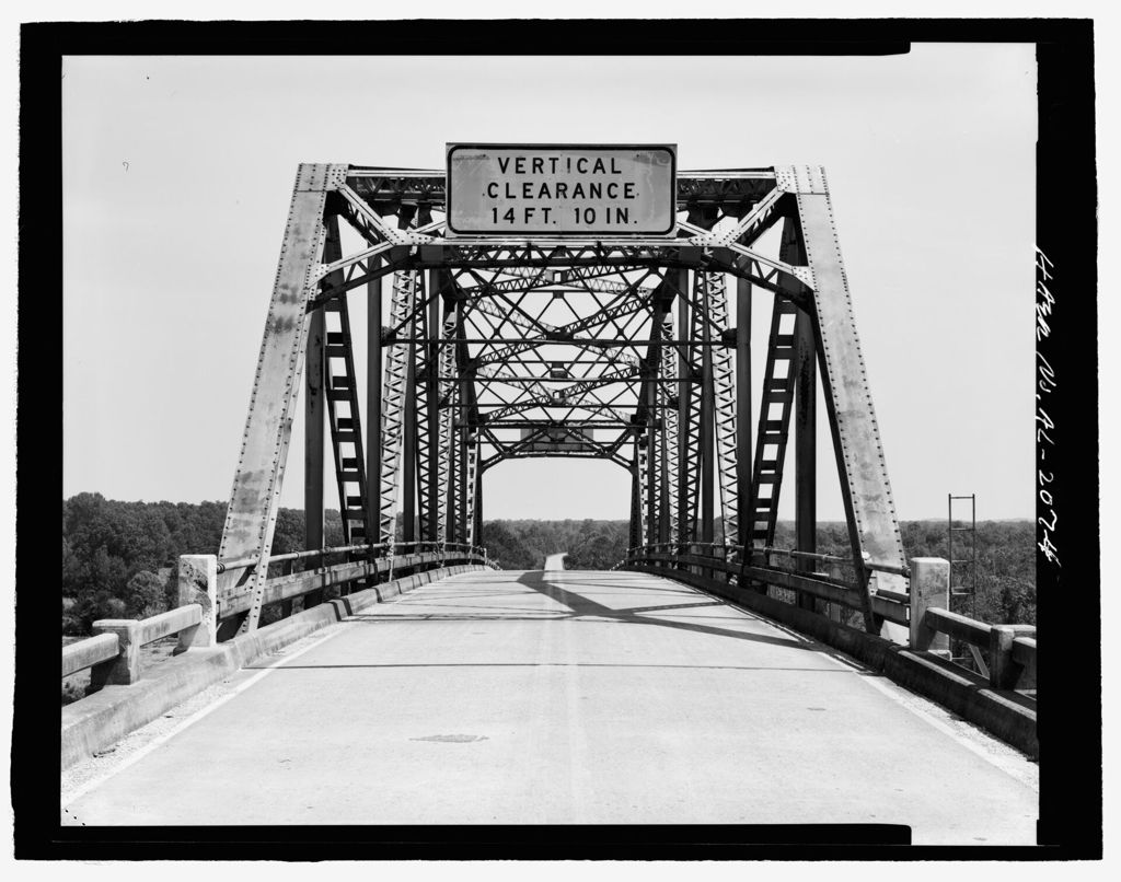
For years an old steel truss bridge carried the road across the river near town. Bridges like it once stood on most river crossings in the region, and many have since been replaced by plain concrete spans.
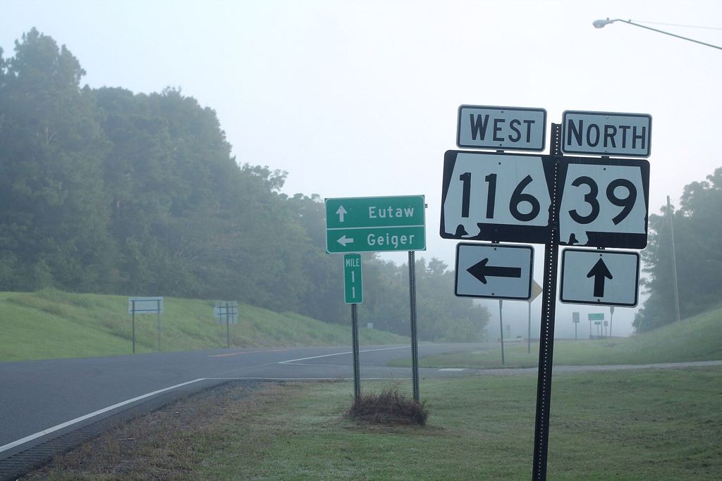
Gainesville sits where two state roads meet. Highway 39 runs north toward Eutaw and Greene County and south toward Livingston; Highway 116 heads west toward Geiger and the Mississippi line. Early mornings here often bring fog off the river, so drive with lights on until it lifts.
Gainesville is very quiet today. There are few services, and opening hours for anything you might hope to find are not something to count on, so bring water and food and fill your tank before you leave. March, April, October and early November make the easiest walking weather.
Summer here is long, hot and humid, and the heat builds quickly after mid-morning. Insects are thick near the river in warm weather, so a repellent helps. Winter days can be mild and clear, with bare trees that open up views of houses hidden by leaves the rest of the year.
The town pairs well with the county seat. Spend the morning on the square in Livingston, around the Bored Well, then drive north in the afternoon, when the light on the old houses is soft. If you want more river after that, the bluffs downstream at Epes and the site of the old French fort are on the way back.