Livingston: the courthouse square and the Bored Well
The county seat is small enough to walk in an afternoon. Start at the artesian well on the square, take the side streets slowly, and finish on the old campus at the edge of town.
- From LivingstonCounty seat
- Eramany eras
- Getting thereInterstate 20/59, then Highway 11 into town
- BringA cup for the well, walking shoes
Look for
- The artesian Bored Well on the square
- The courthouse at the center
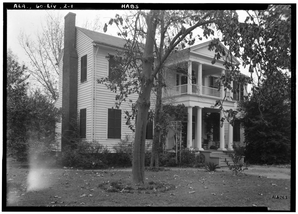
- Tall chimneys on old frame houses
- Pointed windows in the older churches
- The covered bridge on the campus
Park once near the square and walk; the side streets are short and shaded. The old houses are private homes, so look from the sidewalk and stay out of yards.
A town laid out around a square
Livingston has been the seat of Sumter County since the 1830s. The land here was Choctaw country until the 1830 treaty that forced the Choctaw Nation to give up its homeland east of the Mississippi, and when the new county was drawn on that ceded land it needed a courthouse town. The one it got follows the old Southern plan: a courthouse in the middle of a square, offices and stores facing it on all four sides, and churches and houses spreading out along the streets behind.
That plan still works for a visitor. Everything worth seeing in the center sits within a few blocks, and the square gives you a fixed point to come back to. The town sits on the Sucarnoochee River rather than the Tombigbee, which runs a few miles to the east, so there is no waterfront here. What Livingston has instead is water coming up out of the ground in the middle of town.
Shops and offices around the square open and close over the years, as they do in every small county seat. Take the square as it is on the day you come.
The Bored Well
The Bored Well is an artesian well on the courthouse square, sunk in the years before the Civil War. The water rises under its own pressure from a water-bearing layer far below the chalk, and it has been running for a very long time. People in town have drunk from it for generations, and you will often see someone filling a jug. The water has a mineral taste that some people like and some do not.
Whether to drink it is your own call. It is not a bottled product and nobody tests it on your behalf the day you visit. Many visitors simply wet their hands, look at the flow, and move on. Either way, it is the clearest single reason the square looks the way it does: a public well in the middle of a dry chalk prairie was worth building a town around.
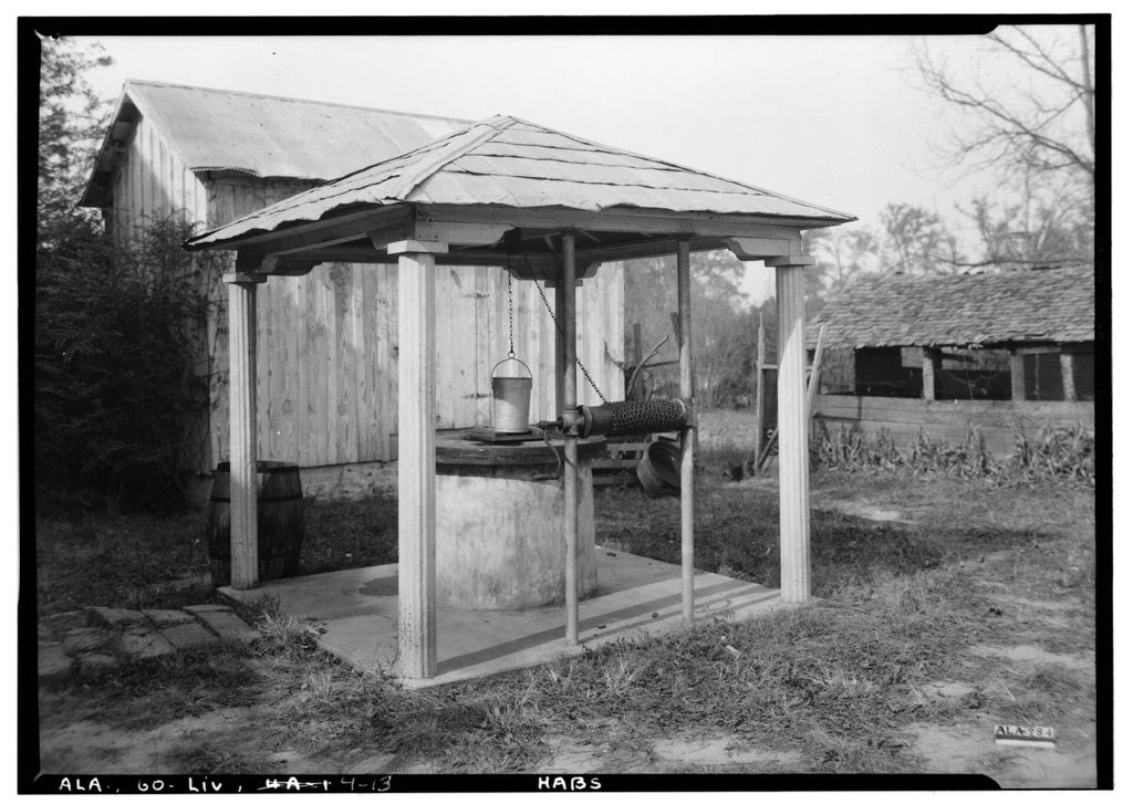
Wells were once part of almost every yard in town. The photograph above shows one in 1936, with its bucket on a chain, a small roof over the top and a barrel set against the post. Most of these private wells are long gone or capped, which is part of why the public one on the square still matters to people.
The side streets
Walk out from the square in any direction and the houses begin within a block or two. Many are frame houses with tall brick chimneys at the ends, porches across the front and big trees in the yards. Some are older than the Civil War; others went up in the decades after. They are lived-in homes, not museums, so the view from the sidewalk is the whole visit.
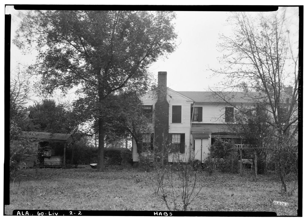
Look at the backs of the old lots as well as the fronts. The outbuildings, the sheds and the line of the old kitchen gardens tell you how a household ran before running water and electric light. Look too at how the wealth of these houses was made. In the 1850s most of the people living in Sumter County were enslaved, and the cotton they grew on the prairie farms around town paid for much of what you see on these streets.
Elsewhere in the county: The Black Belt: chalk soil, prairie and history
If the history of the land itself interests you, the page on the chalk soil and the history of the Black Belt explains why this prairie grew so much cotton, and what that meant for the people forced to work it.
Churches near the square
Several congregations have worshipped near the square since the town's early decades, and the older church buildings are easy to spot by their pointed windows and simple frame or brick walls. Churches are places of worship first. Look from outside unless a door is open and someone invites you in, and keep clear of the steps and drive on Sunday mornings.
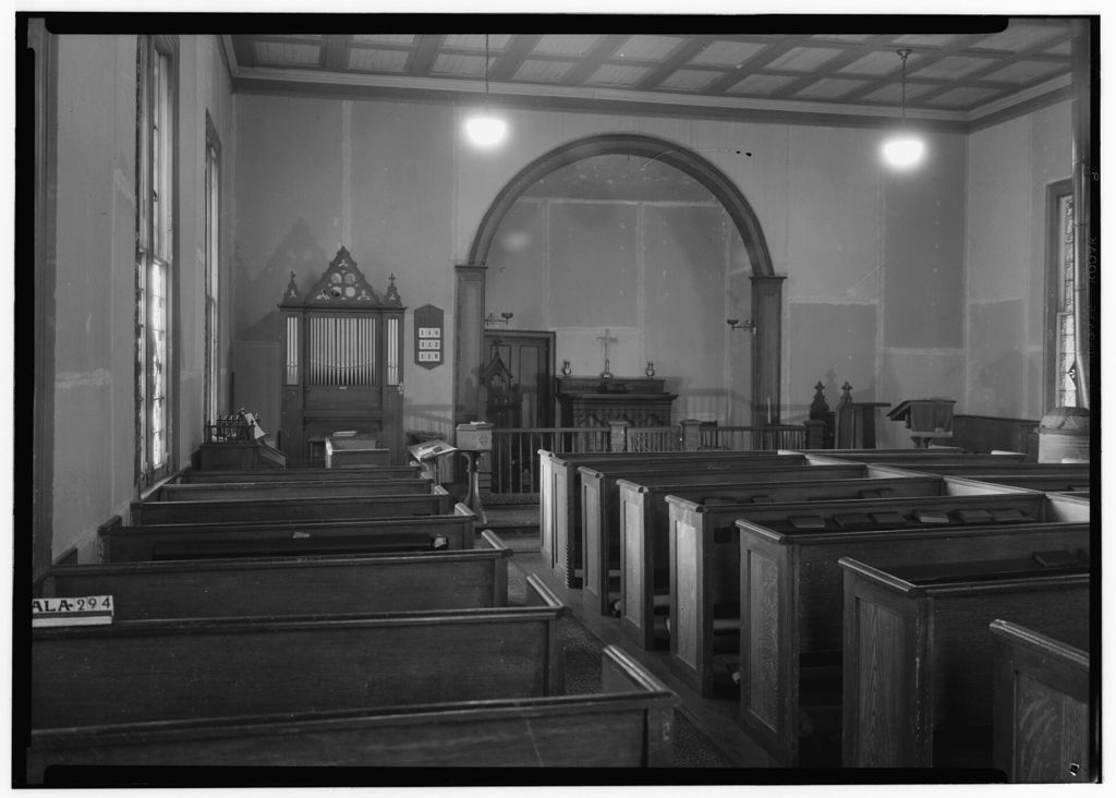
The interior views here were made in 1936 and show a plain room: an arch framing the altar, a small organ with pipes in a carved case, a hymn board, oil lamp brackets on the wall and rows of boxed wooden pews. Nothing in the room is grand, and that is the point. A small Southern town church of the period was built by and for a congregation that knew every family in the pews.
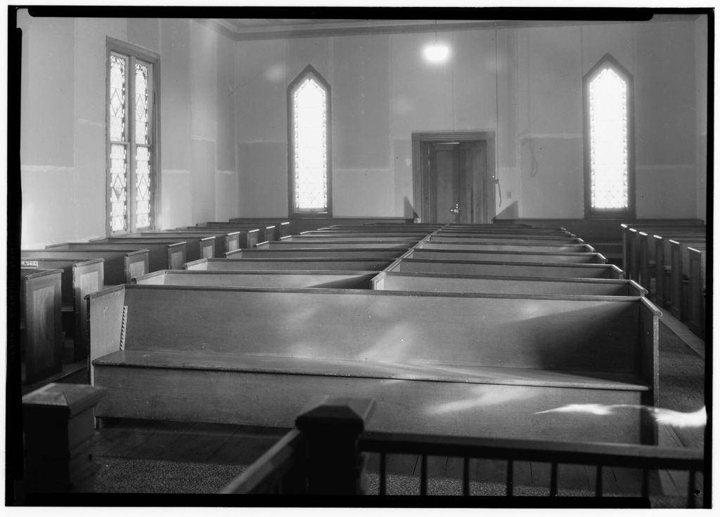
Light in rooms like this came mostly through tall windows, here with diamond panes and pointed tops.
Nothing in the room is grand, and that is the point.
The university on the edge of town
The campus on the edge of Livingston began in 1835 as a school for girls. Over the next century and a half it became a teachers' college, then a state college, and today it is the University of West Alabama. Julia Tutwiler, who campaigned for the education of women and for reform of Alabama's prisons, led the school for many years in the late 1800s and early 1900s.
The campus is open to walk on during the day. Look for the old wooden covered bridge that was moved here from a creek crossing elsewhere in the county, and for the small lake and lawns around it. The university also keeps a museum about the region's natural and human history, from the fossils in the chalk to the Choctaw and the later towns. Its hours follow the academic calendar.
Students change the feel of the town. During term, the streets near campus are busy in the late afternoon; in the summer and over the winter break, Livingston is very quiet.
A loop of the square, the well, a few side streets and the campus takes two or three hours at an easy pace. The cooler months, from October to April, treat a driver and a walker best. Summer afternoons are hot and humid, and the shade on the square is limited, so start early from June through September.
From Livingston, the county opens out in every direction. North on the state road lies Gainesville, the old river town, where cotton went down the Tombigbee to Mobile. Southwest on Highway 11 is York, the town the railroads made. And a short drive northeast brings you to the river at Epes and the white chalk bluffs of the Tombigbee, where a French fort stood in the 1700s.
Before you go, check the weather and any events on the square or on campus, since a home game or a graduation fills the small town quickly. Then park once, walk slowly and let the well be the first stop.